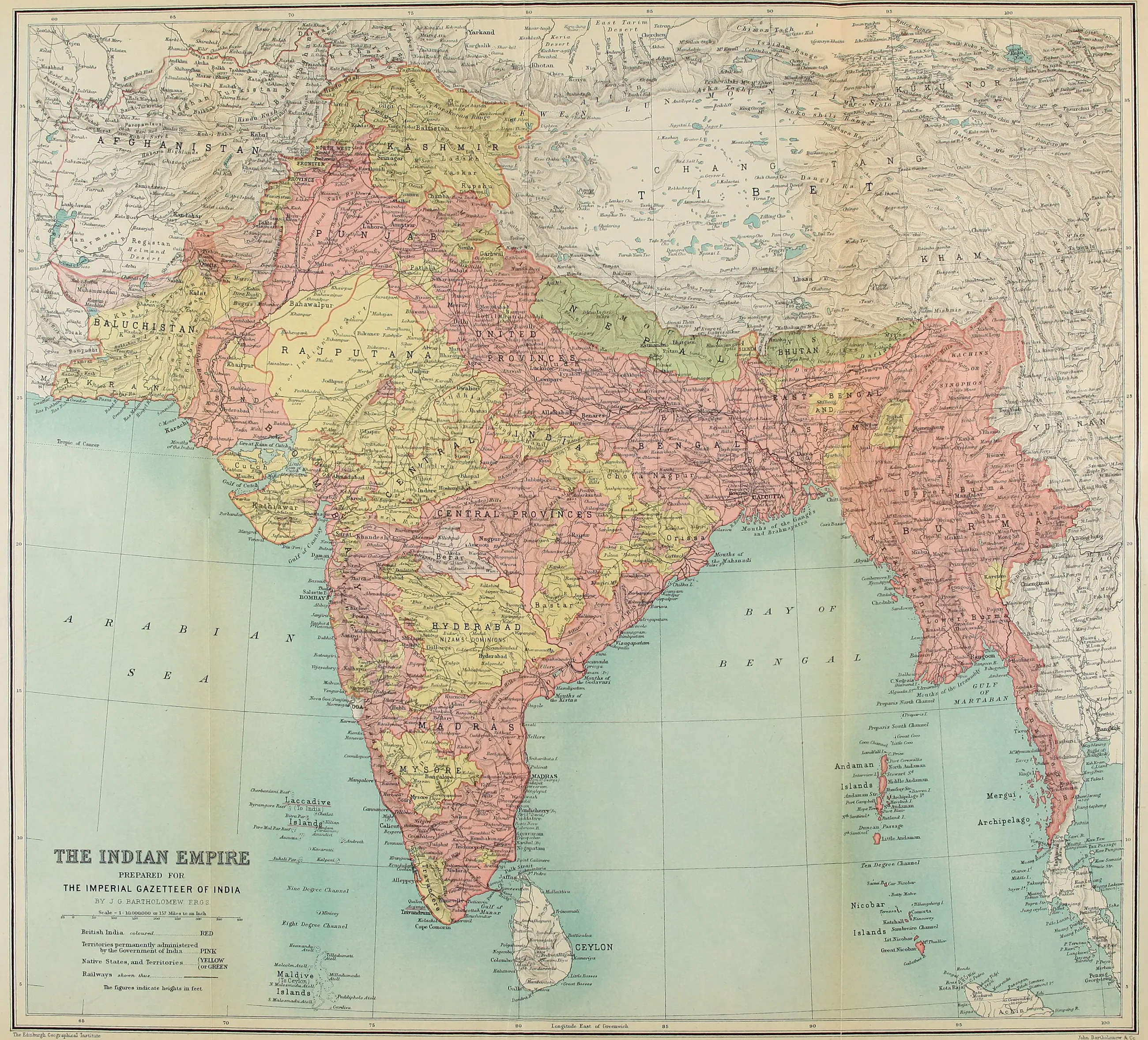
PREPARED FOR
THE IMPERIAL GAZETTEER OF INDIA
BY J. G. BARTHOLOMEW, F.R.G.S.
Scale 1 : 10,000,000 or 157 Miles to an Inch
British India coloured .................................... RED
Territories permanently administered by the Government of India ......... PINK
Native States, and Territories ......... (YELLOW (OR GREEN
Railways shewn thus .......................................
The figures indicate heights in feet
The Edinburgh Geographical Institute
John Bartholomew & Co.
VOL. IV
ADMINISTRATIVE
NEW EDITION
PUBLISHED UNDER THE AUTHORITY OF HIS MAJESTY'S SECRETARY OF STATE FOR INDIA IN COUNCIL
OXFORD AT THE CLARENDON PRESS 1907
HENRY FROWDE, M.A. Publisher to the University of Oxford LONDON, EDINBURGH NEW YORK AND TORONTO